
Beyond the Forecast Screen
A surf forecast can tell you the expected swell height, period, direction, wind and tide, yet it cannot fully explain why one stretch of shoreline delivers a clean, peeling wave while another nearby remains soft and disorganized. Digital models are valuable starting points, but they describe moving water at a broad scale. The final character of a wave is decided much closer to shore, where the swell encounters sandbars, reefs, channels, shelves and subtle changes in seabed depth.
Approaching the coast as an evolving natural tapestry makes each session more rewarding. The same beach may offer a gentle sunrise glide, a faster mid-morning wall and a completely different line after an afternoon tide change. That transformation is governed by bathymetry, the shape and depth of the ocean floor, working together with tide, wind and swell direction. For travelers planning an unhurried morning by the water, the most useful habit is to combine the forecast screen with direct observation. The coastline itself is the final, living forecast.

The Architecture of Shallow Waters
Bathymetry is the underwater equivalent of a landscape map. It records the contours, shelves, depressions and rises that form the seabed, creating the submerged architecture over which waves travel. In deep water, a swell can move with relatively little interference. As it approaches land and encounters progressively shallower water, its lower portion begins to feel the bottom. The wave slows, its wavelength shortens and its energy becomes concentrated vertically, a process known as shoaling.
Shoaling is not simply a matter of waves becoming larger. The seabed also influences where the crest bends, how evenly it approaches the beach and whether the wave spills gradually or pitches forward with more force. When one part of a wave reaches shallow water before another, that portion slows first. The crest pivots toward the shallower contour, a process called refraction. A headland, offshore bank or angled reef can therefore focus energy into a particular section, while a deeper bay may disperse it and produce softer, less defined surf.
Operational ocean models are useful because they provide a structured picture of swell height, period, direction and other wave parameters over large areas. For example, the Coastal Marine Forecasts by Zone for Boston demonstrate how regional marine advisories organize conditions in relation to local coastal waters. Still, a regional forecast cannot capture every sand ridge or reef ledge at a specific break. A long-period swell may arrive with impressive energy, yet its success depends on whether the nearshore gradient receives that energy at a productive angle.
- Steep nearshore contours often encourage quicker, more abrupt breaking.
- Gradual sandy slopes may create spilling waves with a longer, gentler shoulder.
- Angled reefs and headlands can refract and concentrate wave energy into defined take-off zones.
- Deep channels can interrupt otherwise uniform breaking and alter paddle-out conditions.
Shifting Sands and Reef Contours
Not every underwater feature holds its shape. Sandbars are temporary landforms created and modified by waves, tides and currents. A beach that offered a neat central peak after a calm spell may develop two peaks after a storm, or lose its most reliable bank during a period of strong wave activity. This fluidity is one reason beach breaks can feel new from one visit to the next. The seabed is not a fixed stage; it is continually being edited by moving sediment.
Reefs and rocky shelves tend to provide more stable foundations, although stability does not mean uniformity. A reef may have a shallow shoulder, a deeper channel and a steep ledge within a short distance. Tidal depth can make one part of the formation active while another remains submerged and smooth. Sand may also accumulate beside a reef, creating a hybrid break whose character changes as sediment settles or is removed. Such locations reward careful scouting and respect for exposed rock, strong currents and changing water levels.
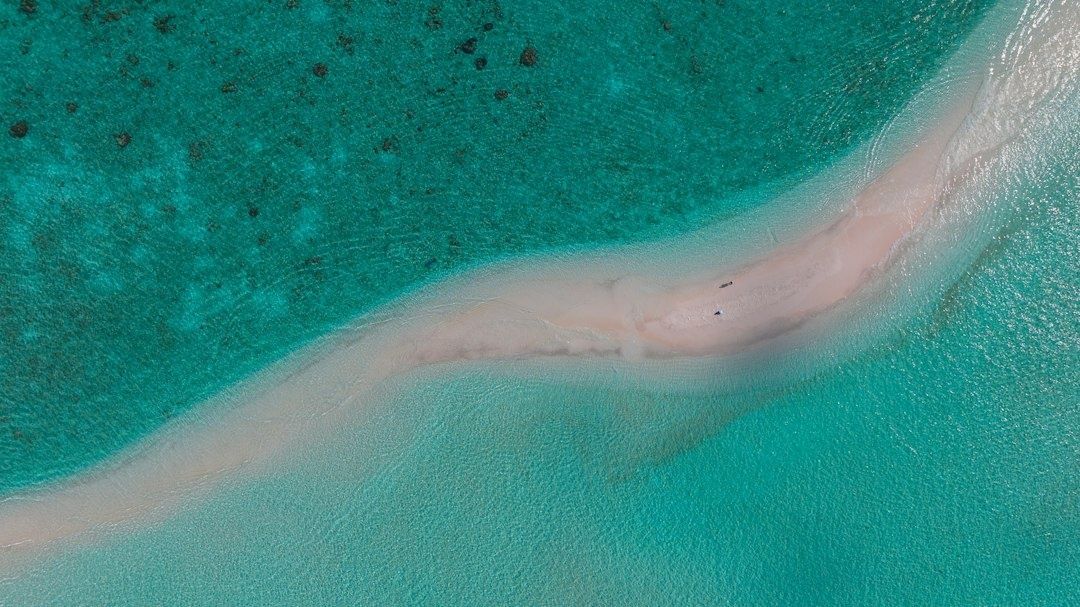
From shore, sand movement can often be read through the surface pattern of the water. A darker, calmer-looking gap may indicate a rip channel carrying water seaward, while a line of broken waves on either side can reveal the edges of a gutter. A shallow sand spit may show as a persistent tongue of whitewater, with deeper water beside it appearing darker and less disturbed. Research on nearshore circulation and rip-current forecasting is available through canr.msu.edu coastal research, though any access decision should be based on current local conditions, lifeguard guidance and personal ability.
| Feature | What it may look like from shore | Why it matters |
|---|---|---|
| Sandbar | A recurring line or peak of breaking waves | Can focus swell and create a defined take-off zone |
| Rip channel | Darker, relatively wave-free water between breaking areas | May carry water offshore and affect positioning or safety |
| Gutter | A deeper trough between the beach and a bar | Can alter wave shape and provide a channel for moving water |
| Reef ledge | A consistent breaking line over a fixed shallow section | Often produces reliable shape but may expose hazards at lower tide |
The Tidal Choreography and the Peak Window
There is no universal best tide. A low tide may sharpen a beach break by placing more of the wave”s energy over a shallow sandbar, while a high tide may provide the depth needed for a reef wave to hold its shape without breaking too early. Some points become smoother as water rises over their shelves. Other breaks lose definition when extra water allows the swell to pass over the contour without enough compression to form a clean face.
The practical question is not whether high or low tide is superior, but where the tipping point lies at a particular break. At one stage, a wave may arrive as a soft lump because the seabed is too deep. A modest change in water level can bring the same wave into contact with a productive contour, allowing it to steepen and peel. A further drop may make the wave faster and more hollow, but it may also cause closeouts, expose rock or intensify rip currents. The best window is therefore a relationship between depth, swell period, direction and bottom shape.
Many locations offer a useful quality period around their preferred tidal stage, but the duration varies and should never be treated as a fixed promise. Tidal currents can shift the active zone, particularly around channels, points and inlets. An incoming tide may gradually cover a shallow ledge, while an outgoing tide can draw water across a bank and change the wave angle. A thoughtful arrival plan follows the water rather than forcing a session into a predetermined schedule.
- Check the tide stage alongside the swell. Note not only the height of the tide, but whether the water is rising, falling or approaching slack.
- Identify the break”s bottom type. Sand, reef, rock and mixed seabeds respond differently to the same change in depth.
- Watch several sets before entering. Compare where waves break, how the shoulders travel and whether the channel is moving strongly.
- Reassess after the tide turns. A break can improve or deteriorate quickly once water begins moving in the opposite direction.
The Art of Coastal Observation
The most refined reading of a surf window begins with the senses. Water color can reveal depth changes, with darker sections often suggesting deeper channels and lighter or more textured areas indicating shallow sand. Surface texture shows the influence of wind and current. A smooth, glassy patch may mark a sheltered line, while a ruffled band can expose opposing flow or wind stress. The angle at which waves peel is equally valuable. A clean shoulder that travels steadily in one direction usually signals a more organized contour than a peak that collapses evenly across its face.
Patience is an essential part of this process. Spend a few minutes watching full sets rather than judging a break by one isolated wave. Notice whether the first wave of each set breaks farther outside, whether the inside reforms, and whether the apparent channel is actually a safer passage or a powerful current. Tide charts provide timing, forecasts provide context and the shoreline provides confirmation. Together, they create a more reliable picture than any single digital indicator.
- Compare the wave line with the visible shape of the beach and headland.
- Look for repeated peaks rather than one unusually good wave.
- Track where foam travels after a wave breaks to identify current direction.
- Allow extra caution when water color, breaking pattern or shoreline access changes unexpectedly.
Step into Rhythm with the Sea
Mastering the daily surf window is less about chasing an alert and more about arriving with informed attention. A forecast can guide the broad decision, while bathymetry explains the finer details: why the same swell favors one corner, why a sandbar suddenly improves after a storm, or why a tide that looks promising on paper produces flat, uninviting water at a particular reef. This awareness makes a coastal stay feel more seamless, from an early shoreline assessment to post-surf relaxation away from the water.
Every break offers a quiet dialogue between moving swell and submerged form. Learn to recognize that conversation through depth, texture, current and peeling angle, and each visit becomes an opportunity to understand the coast more clearly. Approach the shoreline as an observant naturalist, allow the water time to reveal its pattern, and the best sessions will often feel less like discoveries made by an app and more like moments entered at precisely the right rhythm.
